Set up your farm property map
How AgCore brings cadastral lots, a farm boundary, land facts, water sources and infrastructure into one property record for an Australian farm business.
One property record for the land
Property setup gives an Organisation one map for its boundary, land facts, water and infrastructure. Cadastral lots provide a starting point, while the grower confirms the land that belongs to the business.
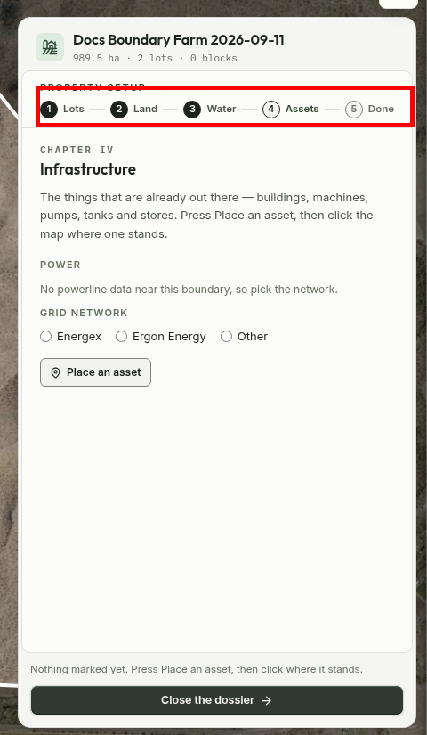
The Property Dossier keeps that record in five chapters: Lots, Land, Water, Assets and Done. The map stays beside the dossier, so the shape and the facts describe the same property.
Land facts stay with the map
The property record keeps the selected lots and boundary with the land facts AgCore can measure from them. That gives the business one place to return to when it needs to understand the property's shape, size or terrain.
In Queensland, AgCore gets lot lines from the Queensland Government Digital Cadastral Database through QSpatial. It may reuse a lookup for up to six hours, while the database itself changes at most nightly. These lines are a starting point, not a fence survey or proof of ownership. A grower can draw the boundary when the government service is unavailable or the farm is outside Queensland.
Measured facts stay distinct from details the grower declares. AgCore can help describe the property without silently replacing the farm's own record.
Water and infrastructure belong to the property
Water the business confirms and operational assets such as pumps, sheds and machinery stay with the same property record. A manager can return to the dossier later instead of rebuilding that picture from a paper map and a separate asset list.
These are property records, not live equipment tracking. They describe what is on the farm and where it belongs in the business.
What happens after setup
Finishing the dossier leaves the Organisation with a boundary and a property overview for everyday farm work. The completed chapters remain available when the business needs to review or update its land, water or infrastructure.
Production Blocks can be added when the grower is ready to describe how the land is used. They sit inside the property record rather than replacing its boundary.
Open AgCore
Already have a login? Open the dashboard and choose the Organisation whose property you want to map.
No account yet? Start a free 60-day trial — the full product, no credit card.